Skip to main content
Login
|
Register
Home
Minerals and Waste Local Plan documents and consultations
Proposed Main Modifications
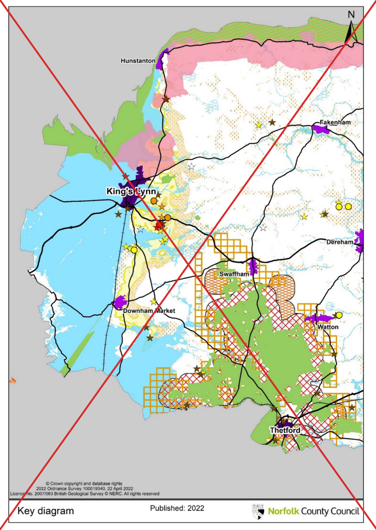
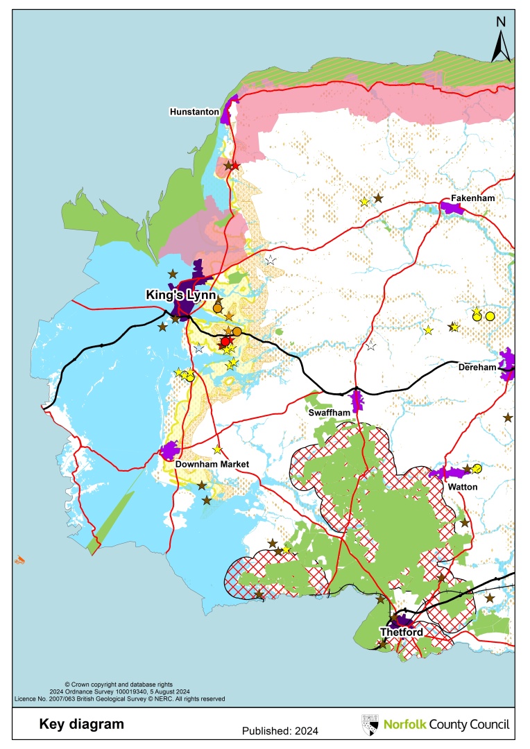
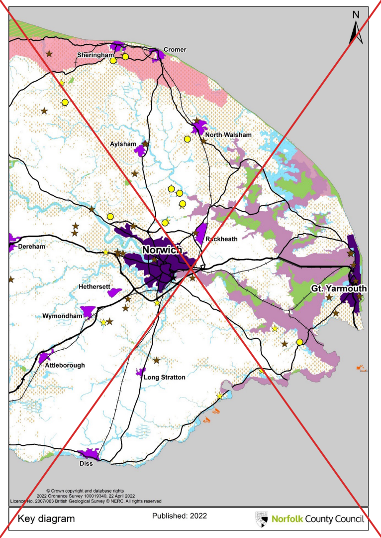
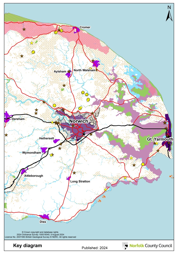
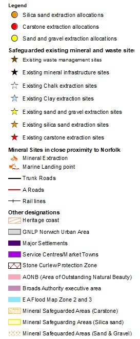
Appendix 1- revised key diagram (MM04)
Proposed Main Modifications
Ended on the 13th December 2024
Search representations
Search representations
Schedule of Proposed Main Modifications to the Norfolk Minerals and Waste Local Plan
MM01 - Vision, Page 19
MM02 - Waste Strategic Objectives WSO7, Page 20
MM03 - Minerals Strategic Objectives, Page 21
MM04 - Key diagram, Pages 22 - 24
MM05 - Policy MW1. Development Management Criteria, Page 27
MM06 - Policy MW2. Transport, Page 37
MM07 - Policy MW3. Climate change mitigation and adaption, Page 39
MM08 - Paragraph 9.2, Page 40
MM09 - Paragraph 9.3, Page 40
MM10 - Paragraph 9.4, Page 41
MM11 - Paragraph 9.5, Page 41
MM12 - New paragraph after paragraph 9.5, Page 41
MM13 - Paragraph 9.6, Page 41
MM14 - Policy MW4. The Brecks Protected Habitats and Species, Page 42
MM15 - Map 2 (and policies map), Page 40
MM16 - Paragraph W0.13, Page 46
MM17 - Paragraph W0.16, Page 47
MM18 - Paragraph W1.10, Page 48
MM19 - Paragraph W2.2, Page 51
MM20 - Policy WP2. Spatial Strategy for Waste Management Facilities, Page 52
MM21 - Policy WP3. Land suitable for waste management facilities, Page 54
MM22 - New paragraph after Paragraph W4.1, Page 55
MM23 - Policy WP7. Household Waste Recycling Centres, Page 57
MM24 - Policy WP13. Landfill mining and reclamation, Page 63
MM25 - Policy WP14. Water Recycling Centres, Page 66
MM26 - Paragraph W15.2, Page 64
MM27 - Paragraph W15.5, Page 64
MM28 - Policy WP15. Whitlingham Water Recycling Centre, Page 65
MM29 - Paragraph MP1.3, Page 68
MM30 - Paragraph MP1.4, Page 68
MM31 - Paragraph MP1.5, Page 68
MM32 - Paragraph MP1.6, Page 68
MM33 - Paragraph MP1.7, Pages 68-69
MM34 - New paragraph before paragraph MP1.8, Page 69
MM35 - Paragraph MP1.8, Page 69
MM36 - Paragraph MP1.11, Page 69
MM37 - Paragraph MP1.12, Page 69
MM38 - Paragraph MP1.13, Page 70
MM39 - Paragraph MP1.14, Page 70
MM40 - Paragraph MP1.15, Page 70
MM41 - Paragraph MP1.18, Page 70
MM42 - Paragraph MP1.20, Page 71
MM43 - Policy MP1. Provision for mineral extraction, Page 72
MM44 - Paragraph MP1.25, Page 72
MM45 - Paragraph MP1.26, Page 72 / 73
MM46 - Paragraph MP2.1, Page 73
MM47 - Paragraph MP2.4, Page 74
MM48 - Paragraph MP2.6, Page 74
MM49 - Policy MP2. Spatial Strategy for Minerals Extraction, Page 75
MM50 - Policy MPSS1. Silica Sand Extraction Sites, Page 77
MM51 - New paragraph after existing paragraph MP5.4, Page 79
MM52 - Policy MP5. Core River Valleys, Page 79
MM53 - New paragraph after paragraph MP7.2, Page 80
MM54 - Policy MP7. Progressive Working, Restoration and Afteruse, page 82
MM55 - Paragraph MP8.1, Page 83
MM56 - Paragraph MP8.3, Page 83
MM57 - Policy MP8. Aftercare, page 83
MM58 - Paragraph MP11.4, Page 85
MM59 - Implementation Monitoring and Review table, Pages 88 to 99
MM60 - Mineral extraction sites - sand and gravel table, Pages 100 and 101
MM61 - Mineral extraction sites - carstone table, Page 101
MM62 - Mineral extraction sites - silica sand, Page 102
MM63 - Policy MIN 12. Land North of Chapel Lane, Beetley, page 107
MM64 - Policy MIN 51/ MIN13/ MIN 08. Land West of Bilney Road, Beetley, page 111
MM65 - Paragraph M96.4, Page 136
MM66 - Policy MIN 96. Land at Grange Farm, Spixworth, page 140
MM67 - Policy SIL01, Land at Mintlyn South, Bawsey, Page 159
MM68 - Paragraph M25.1, Page 180
MM69 - Paragraph M25.23 Restoration, page 184
MM70 - Policy MIN 25, land at Manor Farm, Haddiscoe, Page 184
Appendix 1- revised key diagram (MM04)
Appendix 2 – revised Map 2 'Stone curlew protection zones' (MM 15)
Appendix 3 – revised implementation, monitoring and review table (MM 59)
<< Previous Page
||
Next Page >>
Appendix 1- revised key diagram (MM04)
<< Previous Page
||
Next Page >>
For instructions on how to use the system and make comments, please see our
help guide
.
back to top
back to top